

Northern Territory seasonal outlook
December 2017, Sourced from the Australian Bureau of Meteorology.
The national outlook for December 2017 to February 2018 indicates that:
- drier than average conditions are expected across much of the NT
- warmer than average days and nights are more likely across the entire NT.
Typically when the tropical Pacific cools towards La Niña levels, the western Pacific and seas around northern Australia warm significantly, but models suggest this is not likely to occur this summer. Likewise, La Niña periods typically see warmer than average waters develop in the eastern Indian Ocean. This season, near average to cooler waters are forecast to remain in this area, while warmer waters remain off Africa.
The combination of ocean patterns, and the likely weak La Niña itself, is why Australia does not have significant and widespread increased chances of a wetter and cooler summer.
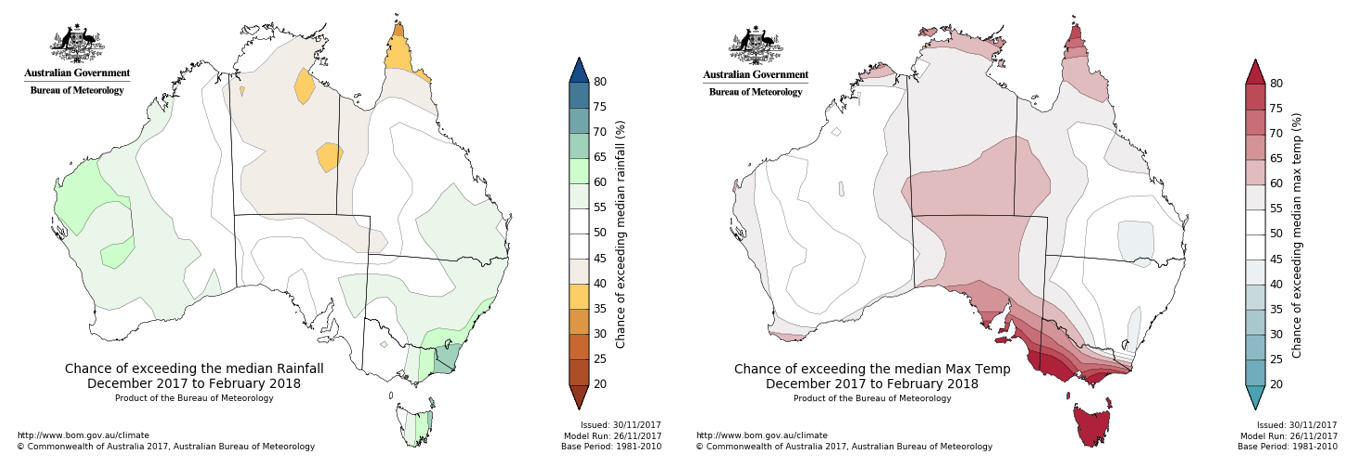
Figure 14.Rainfall and temperature maps from the Australian Bureau of Meteorology
Seasonal indicators | Comments (sourced from the Australian Bureau of Meteorology) |
|---|---|
El Niño Southern Oscillation (ENSO) Current outlook: LA NIÑA | La Niña established in tropical Pacific This 2017-18 La Niña event is forecast to be short-lived and weak, with sea surface temperature patterns in the western Pacific and eastern Indian Ocean not typical of La Niña. As a result, there's little push towards widespread wetter conditions across much of the country. La Niña typically brings above average rainfall to eastern Australia during late spring and summer, however sea surface temperature patterns in the Indian Ocean and closer to Australia are not typical of a La Niña event, reducing the likelihood of widespread above average summer rainfall. |
Indian Ocean Dipole (IOD) Current outlook: Neutral | IOD also neutral. The influence of the IOD on Australian climate is weak during December to April. This is because the monsoon trough shifts south over the tropical Indian Ocean changing wind patterns, which prevents the IOD pattern from being able to form. However, to the south of the traditional Indian Ocean Dipole regions, cooler than average sea surface temperatures in the eastern Indian Ocean may be limiting the feed of moisture over Australia, and opposing more typical La Niña influences. |
Table 3: Seasonal indicator summary from the Bureau of Meteorology (BOM)
Give feedback about this page.
Share this page:
URL copied!